Friday, 19 April 2019

Inisheer Lighthouse


Located on one of the three Aran Islands, Co Galway, Ireland. Inis Oirr (Inisheer) the closest of the three islands is accessible by boat from Doolin (shout out to the Rainbow Hostel!)  A short trip of 30 minutes (felt like a  lifetime) 

Actually, the most memorable moment about this journey was the boat trip. As with many of my lighthouse journeys at the time, bicycle was the chosen transport; However a boat needed to take us to the island. Unfortunately for me, the sea was rough and I fell very ill very quickly. I'm not proud to say I got sick and (considerately may I add) leaned over the side of the boat. What I wasn't expecting (and wasn't even aware was happening at the time) was that the wind took what I expelled and carried it directly on to a young boy standing a few feet away from me. Much to the amusement of his team mates (they were going to the island for a football match) I felt like death coming off the boat. With my head down in shame, I managed to stumble into the nearest pub, and ordered a Sprite. If my memory serves me right some guy at the bar was coming onto me with some horrendous lines. I mumbled something about having puke in my hair and wandered off to collapse in the grass...and he still persisted! Facing a hilly bike ride I started to think we were never going to get to the lighthouse. After about 30 minutes face down in the grass (valuable time lost as the last ferry was leaving shortly) we ventured off. I can't remember much about the ride, the scenery was probably lovely?
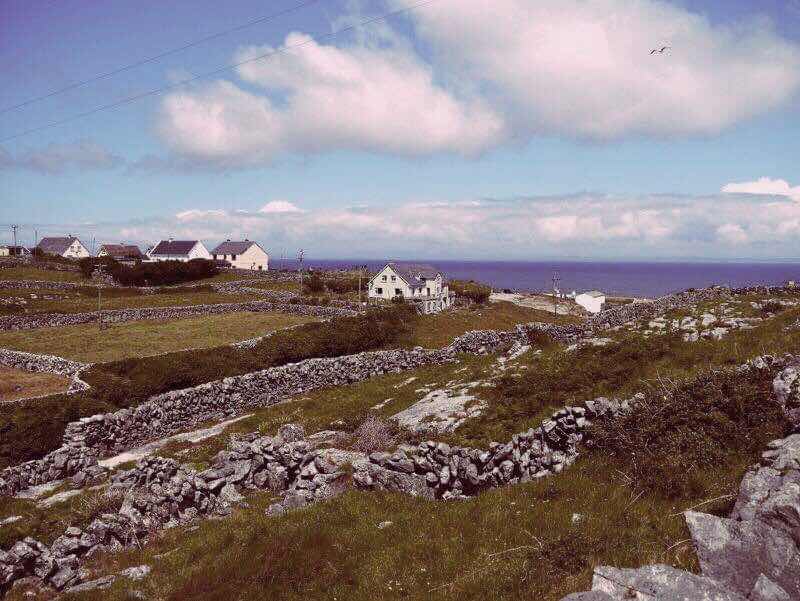


The lighthouse came into view finally! A two mile (hilly!) journey from the pier.  As with most lighthouses there was a gate and keep out signs. The gates were far too high to climb, even for me. We climbed a total of four walls to get into the lighthouse, settled ourselves and prepared to picnic. A short while later, a father and son arrived at the gate. I started to walk towards them to explain the complicated wall climbing entry, when the father just opened the gate and they walked in! 
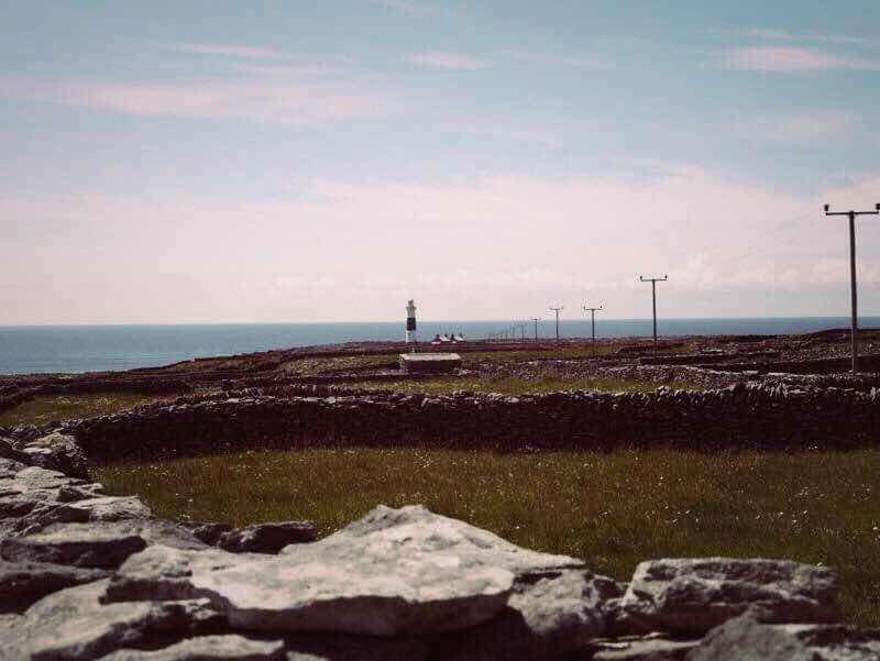


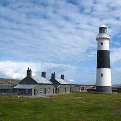
So, the lighthouse! Cool looking isn’t it? The houses and the tower were designed and constructed by George Halpin. They were built from local (and very hard!) chrystaline rock. The first of the three Aran Islands to get a lighthouse was Inishmore. I feel like I write this in every blog post... but the bloody tower was built too high, and the light was often masked by the fog! So, requests were made to build on the other two islands. And there was a bit of fighting about which one (isn’t there always!) and it was finally agreed that both Inisheer and Ereagh would have lighthouses built and establish at the same time December 1857) 


Sunday, 3 June 2018

Fastnet Rock Lighthouse

Located 6km from Cape Clear Island, Co Cork, Ireland. 


There are actually two rocks at Fastnet; Fastnet Rock, and Little Fastnet (what, how cute!) They are separated by a thirty-foot-wide channel. 


There have been two lighthouses built on Fastnet Rock over the years. The decision to build the first one, in 1848, was taken after a wreck of the American ship ‘Stephen Whitney’ in the area, with a loss of 100 lives. 


The new lighthouse on Fastnet would replace the lighthouse of Cape Clear Island. This lighthouse was proven to be too far inshore, and too high (which appears to be a common problem with lighthouse building!) The light would be obscured in foggy conditions. 


Authorities commissioned George Halpin Sr (famous lighthouse head/engineer/builder) to design the new structure. He used cast iron, which was also used to build neighboring lighthouse Calf Rock. Work was finished on the oil burning lighthouse in 1854, soon after which Halpin died. 


In 1881, Calf Rock lighthouse came to an untimely end (it snapped!) in a storm. The lighthouse of Fastnet also had damage to its lantern that night. Officials realised that the lighthouse couldn’t much longer withstand the steady onslaught of the Atlantic Ocean, especially given that it was positioned on the most exposed portion of the rock (the top) A decision was made to start work on a new masonry lighthouse on the lower western part of the rock. 


Construction of the new lighthouse started in 1897, its designer, a Mr William Douglass. It was built under supervision of James Kavanagh, the foreman mason. He hardly saw the shore in the years of its construction, and he sadly died before work was complete. 


The tower is built from 2,047 Cornish granite, dovetailed blocks. It was established in 1904 at a total cost of £90,000. Doesn’t it have a wonderful taper!? The first floor of the original lighthouse can still be seen (black stump at top of the rock) It is used for storage. 


We took a boat tour around the rock. Ferries leave from Baltimore and Schull, and are run by Cape Clear Ferries. 


They include a stop off at Cape Clear Island. There’s a museum about Fastnet, not that we visited it. We decided instead to take a bimble to the top of the island, to visit the old lighthouse of Cape Clear. I packed sandwiches and snacks (ever prepared) We took an opportunity to stop for the picnic at a very pictureqsue spot, where Fastnet was clearly in view. Chowing down I start to realise we weren’t alone on our picnic. TICKS, everywhere! We walked (ran) back down to the pub for pints and a good brush down. Horrid Lyme disease carrying hell bugs. 


Work was being carried out on Fastnet. Scaffolding was up around the lantern. I can best assume that this is work on changing the mercury-driven lights to energy efficient LED lights. Something that has been met with varying differences of opinion. Some say that this takes away some historical value from the lighthouse. I would have to agree. There’s something wonderful about seeing that light seeep across the ocean at night. 


Monday, 16 October 2017

Broadhaven Lighthouse

Located at Gubbacashal Point, on the Mullet Peninsula, County Mayo. This lighthouse stands tall (as does the gate!) at 27 metres. The gate, and no entry signage didn't discourage us though - we even managed to haul a tent and provisions over that gate! Where there's a will! 


Broadhaven is a harbour light. It's purpose; to guide vessels from sea, clear of a sunken rock (sounds pretty dangerous in fairness) on the western side of Broadhaven to a safe anchorage. It was originally meant to be a beacon tower, not a fully fledged lighthouse, as the Lighthouse Board didn't want to be spending too much time or money, as usual! However, pressure from the locals, with support from George Halpin (prominent lighthouse builder) saw it transformed from a beacon to a lighthouse, by the erection of a lantern to the original built beacon tower. Of course this all took a long time, and there was a lot of 'putting it on the long finger'. The lighthouse was established in 1855, twelve years after a lighthouse was first requested for Broadhaven. Back then it was displaying its natural stone grey colour. 

That's the little brother

The keepers dwellings have sadly fallen into disrepair. Which is such a shame, as it's hard for me to imagine a more tranquil spot. We took shelter in our tent close to the wall, that surrounds the lighthouse grounds. The land here is quite exposed, and blustery! We were happy to have the wall I can tell you. The light shone through the night, and into day break. This lighthouse isn't manned of course - I wouldn't be trespassing otherwise! The lighthouse keepers were withdrawn in 1931. Improvements to the light, and a good coating of white paint were also done at this time. 


One last thing - the MULLET peninsula? Lads, I couldn't stop laughing...

Wednesday, 22 March 2017

Blacksod Lighthouse

On the southeast corner of the Mullet Peninsula (perhaps the most hilariously named peninsula in Ireland?) in County Mayo on Ireland’s west coast stands Blacksod lighthouse. A short, two storey building with a square tower, which is quite unusual for a lighthouse tower. 


Built in 1865 with locally quarried reddish-grey granite. Over the years, this granite was shipped all over the world. The lighthouse began operating in 1866 to make Blacksod Bay safer for mariners. The structure also served as a post office from 1969-1972, while a new building was being built, becoming (quite possibly) the only Irish-lighthouse-turned-post-office! 


Myself and my brother had been camping at Broadhaven lighthouse the night before, and drove down to Blacksod around 730am after a very, very wet and windy night in the tent! The sun was shining, and to our delight the door to the lighthouse building was open. Not one to miss an opportunity to step inside a lighthouse - I knocked loudly on the open door. Two men came to the door and I very confidently asked if we could come in! They were part of a maintenance team, and one man explained he has family ties to the lighthouse: The Sweeny family. His dad had been a keeper there for many years. They invited us in and took us up the tower and spoke about the history of the lighthouse. We were so grateful, and exhausted I’m not sure I even explained I have a blog. 


Probably the most popular Blacksod lighthouse story, and one that was shared with us that day, is the story of the Blacksod lighthouse keeper that gave the weather forecast, that enabled General Eisenhower to make a decision to land Allied forces in Normandy, France, on D-Day, June 6th 1944. Meteorologists had predicted a week of bad weather for France at the beginning of June. The Germans believed this forecast and Field Marshall Rommel left the front lines in France to visit his family in Germany. The lighthouse keeper at Blacksod lighthouse predicted a mid-week break in the weather and Eisenhower acted on the prediction. This demonstrates the important job lighthouse keepers held at the time in recording accurate weather reports on a daily basis. 


The lighthouse was automated in 1999, and now also serves as a helicopter base for nearby lighthouses Blackrock and Eagle Island. 


Wednesday, 3 August 2016

Tarbert Habour Light


Located on a tidal rock in the Shannon Estuary, on the northern side of Tarbert Island, County Kerry. A seventy four ft tower established in 1834. Although technically termed a 'harbour light', it certainly looks like a fully fledged lighthouse to me. There are not many lighthouses I've seen with such a distinctly formed taper. 


Built at the request of Limerick Merchants the habour light was deemed necessary to light a treacherous turn in the river and help mark the southern entrance to Clonderalaw Bay to the northeast. The connecting sixty one metre cast-iron footbridge was not constructed until 1841. Not sure this photo captures it - but I've climbed a many gates on adventuring to lighthouses, none have been so small, cute and open as this one!


Small accessible gates aside, this is no place for a casual visitor. In fact, a structure that would have one time towered above every building around, now appears dwarfed beside the neighbouring chimneys of the ESB station behind it. Its light, just a glow in the ESB galaxy. You would wonder of the necessity of a lighthouse there at all now, but nautical traditions (thankfully) die hard, and it is still in operation today, but instead of being maintained by the Commissioners of Irish Lights, it is under the care of the Limerick Habour Commissioners. Not that it matters much to the reader, because this lighthouse is on ESB property (shakes fist) and therefore tricky to get to.


I was lucky to have a friend in tow on this excursion, with a family member in the know of the area, and the power station itself (having worked there himself once upon a time). Discussions were had on the eve of the trip out to Tarbert, and a plan of action was made. Plan (A) being 'lets walk along coast there and see how close we can get'. That's indeed what we did, alas - we were tantalizingly close, but power station workers and a definite feeling of 'keep out' prevented us from climbing any further. Plan (B) was to approach the security guard and ask permission to access the lighthouse. I gingerly walked up to his booth and politely asked about access to the lighthouse, he looked at me, sternly 'this is private property', my friend piped up 'she's writing a book on Irish Lighthouses, she wants to get closer to take photos for the book (never mind the fact I forgot my camera on this trip!). He picks up a phone 'let me see what I can do'. He explains the situation very matter of factly to someone on the other end. 'You can go, he must be in a good mood today', and he directed our passage through the incredibly ugly buildings to the lighthouse. 'It's gated up now, you wont get to the lighthouse, but you'll get close'. Smiles and words of gratitude directed to him as we set off.

Indeed there was a fence, and of course, we got through it, and walked along the bridge right up to the lighthouse. We stayed for around thirty minutes and made our way back. The security guard (Michael O'Connell) was eager to talk to us on our return, now smiling. He spoke of his work, the power station (which is now British owned and only in use during peak demands), the lighthouse, the wildlife and asked about my blog. I passed on my email and blog address to which he responded 'I'll have my daughter help me look it up'. So if you're reading this Michael, hello, and thank you again! I hope your Sycamore is doing well! 


Monday, 30 November 2015

Mizen Head

Located at the tip of a peninsula, in the district of Carberry, West Cork, Ireland.

I had just bought a new bike, so headed out with a friend to cycle from Schull to Mizen Head, and back (50km). Back before I had a car, my trips to lighthouses were nearly always via bike, and I nearly always spent the ride cursing that I didn't have a car! Cycles to lighthouses are definitely more enjoyable though, they give you much more opportunity to experience the scenery around you. 


The tip of the peninsula is almost an island, cut off by a deep gorge. Access to the island (and the lighthouse) is via a suspension bridge (built 2009) pictured below. Mizen Head is well known for being Ireland's most southerly point, and geography books throughout history talk of the length of Ireland 'from Malin Head to Mizen Head'. Malin Head in Donegal obviously being Ireland's most northerly point. Malin Head to Mizen Head is a very popular cycle route (around 600km). Mizen Head is actually not Ireland's most southerly point despite popular belief..that title belongs to Brow Head, which is 9km south of Mizen Head! But whatever right? 


The lighthouse at Mizen Head is not very old at all, it was established in 1959. It was back in 1905 that permission to build a lighthouse here was given by the Board of Trade, but by 1906 it was decided that only a fog signal was needed at this location. In 1907 work started and a reinforced concrete bridge was built to give access to the island, the design of which was chosen from a competition (this bridge was later replaced in 2009). 1908, and still no fog signal established - the SS Trade was wrecked at Mizen Head, which the master of the vessel blamed lack of a fog signal (not his steering skills obviously). Sixty three lives were saved by a resident engineer and workmen that were at the site at the time of the wreck. 1909 the fog signal was finally established, and keepers dwellings were built. The fog signal was explosive charge that was fired at intervals, and the buildings were white washed to act as a better day mark. All went on well until 1920 when there was an armed raid on Mizen Head and nearly all the explosives were taken. No protection was offered from the government at the time, so the board had no choice but to withdraw all explosive fog signals from all the stations around the coast. Sad time for 4 years (and a few wrecks) until the fog signal was re-established in 1924. In 1931 a radio beacon (first in Ireland!) was established at Mizen (later discontinued in 1999). 1959 and a light was established at Mizen! 1968 a radio beacon (racon) was added which was swiftly followed by the fog signal being withdrawn. 1993 the light was converted to automatic and the keepers withdrawn from Mizen Head. 


Now, the Mizen Head Lighthouse is in fact, just an oversized lightbulb! It didn't require a tower building as it already stands at such a height above sea level. It was at this point I realised something about lighthouses...the tower itself is a very symbolic construction. A tower is something that we, or at least I, associate with seeing out, being up, feeling safe. It's stong and unmovable, standing tall above the sea. This lamp at Mizen Head wasn't inspiring. That doesn't take away the fact that it still serves a great purpose - guiding sea folk away from rocks, preventing many a shipwrecks, but for me, it didn't feel like a fully present lighthouse. Perhaps I'm being too harsh? The views however, awesome. 


Sunday, 30 August 2015

Copper Point Lighthouse

Located on Long Island (Inishfada), an island that lies south of Schull, County Cork, Ireland. Named Long Island no doubt because it is 4.8km long and only 0.8km wide (I still managed to get lost!) A five minute ferry journey will take you to the island. You will be stuck there a few hours however, as there are only two ferry crossings in one day. There are no shops or pubs (bring a picnic) and the island has only 10 permanent residents. I met one man (whom I couldn't understand a word he spoke), and a friendly dog. 


It was erected in 1864 as an unlit beacon. It was 113 years later in 1977 that a lantern (more of a light bulb) was placed on top, and in 1981 it became an established lighthouse. 


I think it could well be the ugliest lighthouse in Ireland! Yes I tried to climb the ladder, but got scared. It's higher than it looks!